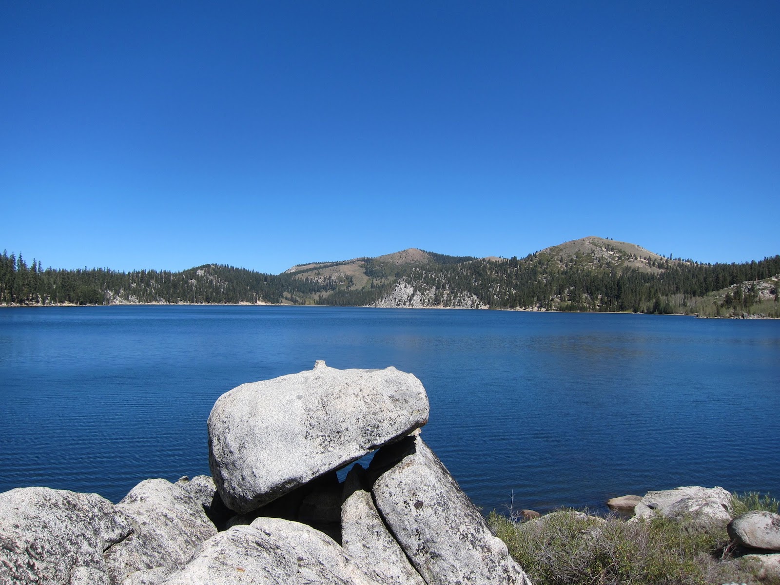
We had a mini adventure in Tahoe, Nevada with Incline Village as our base camp. We enjoyed the 5 Lakes hike near Alpine Meadows. We found all 5 lakes. The one below was the biggest and the prettiest (the one on the lower left corner in the Google Map).
 |
| Largest of the 5 Lakes. |
 |
| Between the largest lake and another lake. |
This lake was also quite serene.
 |
| Lake with some ducks. |
Here is our route on a Google map (7.88 km/ 5 miles total) and the elevation profile for the 5 Lakes Hike.
 |
| Our GPX for the 5 Lakes Hike. |
 |
| Our Elevation Profile for the 5 Lakes Hike. |
Our next adventure was the "world famous" Flume Trail. Our hosts dropped us off at Spooner Lake and then we road back to their house, which meant we had a very nice one way ride. The first part of the route is on a steep, dusty dirt road up to Marlette Lake. We were rewarded for our hard work with a beautiful lake and a bald eagle! Unfortunately, we didn't get any good photos of the bald eagle, but it dove for some fish in the lake right next to us and it also made the classic eagle screech.
There is a brief glimpse of the eagle in this video.
 |
| Lunch at Marlette Lake. |
 |
| Marlette Lake |
Juliette riding by Marlette Lake onto the Flume Trail.
After the lake it was onto the Flume Trail!
 |
| Our first look at Tahoe from the Flume Trail. |
 |
| Sand Harbor from the Flume Trail. Looks like a postcard. |
 |
Sand Harbor below.
The Flume Trail has spectacular views, but is not for people frightened of heights.
|
 |
| Juliette on the Flume Trail with a steep drop off to the right. |
 |
| Taking a break on the Flume Trail. |
We finished the Flume Trail and next was a sandy and slippery ride down Tunnel Creek Road.
 |
| We finished the Flume Trail. |
 |
| Awesome view from Tunnel Creek Road. Just watch out for the sand. |
 |
| Sandy Tunnel Creek Road. |
Here is our route (24.7 km/ 15 miles total) for the Flume Trail and the elevation profile (we didn't have good signal for this elevation profile so there are some gaps).
 |
| Our route for the Flume Trail. |
 |
| Elevation Profile for Flume Trail Ride. |
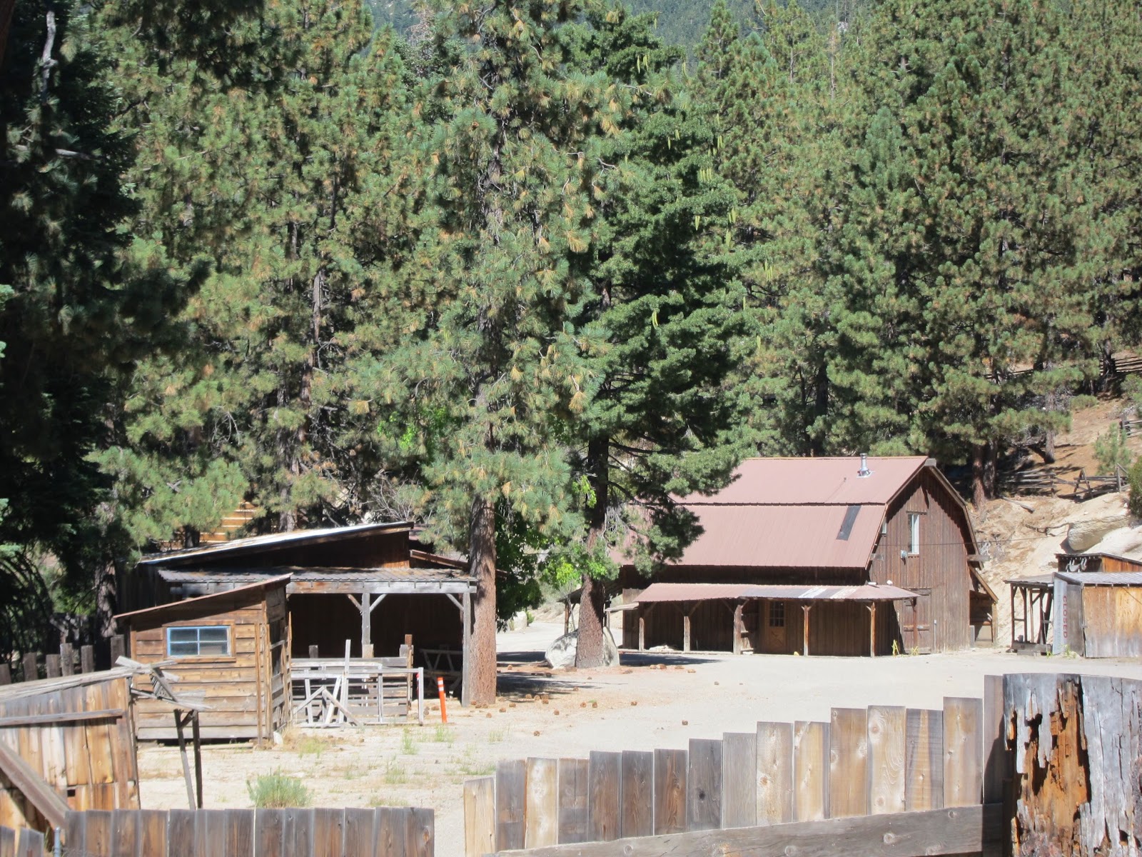
To our surprise at the end of the Flume Trail we came across an area that was used for filming the tv show "Bonanza" and also used as a Bonanza amusement park. Bonanza must be popular in Germany (Andreas had seen the show, but I had not).
 |
| Keep Out signs in English and German. |
 |
| Bonanza Buildings |
On our last day we went kayaking in Sand Harbor. What a beautiful spot with such clear, blue water.
 |
| Andreas' view from the Kayak |
 |
| Clear Water of Sand Harbor |
 |
| Sand Harbor |